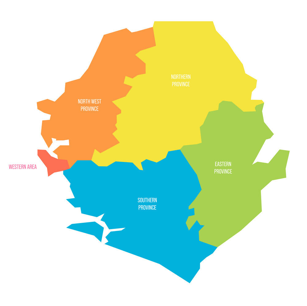
Search
Close this search box.

Regional Boundaries

The House of Parliament, on 10th May 2016, conveyed the prescription of ordinary seats to be 132 in respect of Ordinary Members of Parliament.
*************************
The number of multi-member ward localities decreased from five (5) localities in 2008 to four (4) localities 2017. The reduction of the number of multi-member ward localities increased the total number of wards from 394 wards in 2008 to 446 wards in 2017.
Land That We Love
0
Regions
0
Districts
0
Constituencies
0
Chiefdoms
0
Wards

Eastern Region

The region is divided into 3 districts includinig Kailahun, Kenema, and Kono districts. For the purpose of electing members of parliament and Councilors to the Eastern region, the region is divided into 30 constituencies and 99 wards respectively

Northern Region

The region is divided into 4 districts including Bombali, Falaba, Koinadugu, Tonkolili districts. For the purpose of electing members of parliament and Councilors to the Northern region, the region is divided into 26 constituencies and 89 wards respectively

North Western Region

The region is divided into 3 districts including Kambia, Karene, Port Loko districts. For the purpose of electing members of parliament and Councilors to the North Western region, the region is divided into 21 constituencies and 75 wards respectively

Western Rural

The region is divided into various constituencies, wards, and villages. For the purpose of electing members of parliament and Councilors to the Western Rural district, the region is divided into 8 constituencies and 27 wards respectively

Western Urban

The region is divided into constituencies and wards. For the purpose of electing members of parliament and Councilors to the Western Urban District, the region is divided into 20 constituencies and 48 wards respectively

Southern Region

The region is divided into 4 districts including Bo, Bonthe, Pujehhun, Moyamba districts. For the purpose of electing members of parliament and Councilors to the North Southern region, the region is divided into 27 constituencies and 108 wards respectively

Forward

The  Electoral Commission For Sierra Leone (ECSL) is submitting this report on the delimitation of constituency and ward boundaries in adherence to its constitutional mandate to delimit electoral constituency and ward boundaries, to be done “not less than five years and not more than seven
years”; and complying with the timeline as stipulated in the ECSL Electoral Calendar (2015-2019). The report is subject to Parliamentary approval, as enshrined in the 1991 Constitution of Sierra Leone (Act No 6 of 1991); which inter alia states delimitation of electoral boundaries to be done by
NEC, while Section 38 (1) empowers the Commission to divide the country into constituencies for the purpose of electing Members of Parliament (MPs) using Single Member First- Past –the Post (FPTP) system. The Local Government Act of 2004, Part 1 –preliminary, assigns the task of
drawing wards to ECSL; while the Public Elections Act, 2012 (Section 14, sub-sections 1 &2) forms the legal basis for the allocation of council seats and delimitation of wards in Sierra Leone. The Commission appreciates the level of technical assistance, collaboration and cooperation it
received from Statistics Sierra Leone (SSL), the Boundary Delimitation Technical Committee (BDTC), the Boundary Delimitation Monitoring Committee (BDMC), donor partners, line Ministries, Departments and Agencies and other key actors in the boundary delimitation exercise.
The hiring of a Consultant, Dr Lisa Handley, an internationally renowned Boundary delimitation expert, added credence and credibility to the process as she provided professional advice which assisted in maintaining international standards and best practices.

ECSL is equally mindful of the support it received from stakeholders, including Political Parties, Paramount Chiefs and Members of Parliament, in the sixteen electoral districts while sensitization and public consultations were done at national and districts level on the boundary delimitation
process. The discussions were frank and participatory. In a bid to maintain standards and comply with its legal mandate, the Commission ensured greater consultations with political parties, stakeholders, representatives from district councils and municipalities, whose contributions were laudable in the finalization of this report. The conduct of the boundary delimitation nationwide exercise had its challenges. Nevertheless,
consensus was reached in the final analysis in the sixteen districts where electoral boundaries delimitation, information sharing, consultations and validations were held. This exhibits the spirit of mutual consent and acceptability of a process which serves as a gateway to representativeness in the country’s democratic dispensation. The Commission is of the view that the numerous public consultations, backed with the expertise of
its technical staff and staff of SSL, use of effective GIS software and database added credence to the accuracy and credibility of the Boundary Delimitation of 2016. This by extension is indicative that the boundaries produced have been well defined and mapped efficiently and accurately, taking in to consideration the valuable inputs of the stakeholders engaged in the process.

The Commission shall continue in its stride to maintain professional standards and best practices in the conduct of electoral processes leading to the conduct of credible and transparent elections. Together, we shall remain committed to adhering to the guiding principles and constitutional
mandate of the Commission for the sustainable growth, economic development, democracy and good governance.

Please highlight and press Ctrl + C to copy.

Scroll to Top